Cuba at Risk: BP Deepwater Horizon Oil Spill

Latest Summary Posted: 6-July-2010

Visit this page for current information on the BP Deepwater Horizon oil spill’s potential impacts on Cuba. More detailed information, including technical reports and satellite imagery can be found here.

Summary: On July 1st, the National Oceanic and Atmospheric Administration (NOAA) released the results of long-term modeling studies predicting the probability of shoreline threat from the BP Deepwater Horizon oil spill (see figure below). The results focus on shoreline impacts and do not consider the continued use of dispersants at depth. The results are generally consistent with the results of its Gulf oil spill modeling efforts of the National Center for Atmospheric Research (NCAR) which released its results on June 3rd. The NOAA model shows moderate risk to Cuban shores, the highest risk being along Cuba’s northwestern coast (Pinar del Río province).  In contrast, the NCAR model shows a very high risk to Cuban shores, the highest along northwestern Cuba, but with a worst-case scenario of oil impact along the entire northern Cuban coastline.

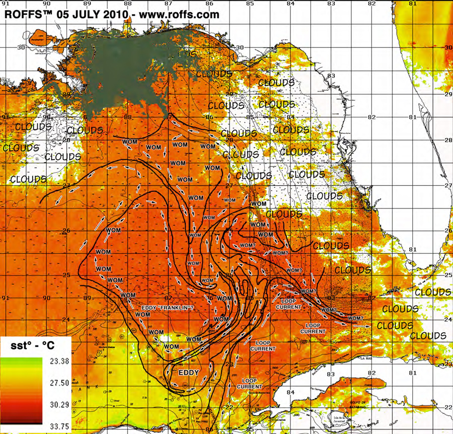
Note: Our updates have been less frequent because NOAA has suspended its offshore oil forecasts. A persistent eddy feature (Eddy Franklin) has dominated the central Gulf and has prevented oil from entering the Loop Current. Presumably, NOAA will resume its offshore forecasts should this situation change. In addition, Roffer’s Ocean Fishing Forecasting Service has discontinued its daily updates and is providing periodic updates only at this time. Please see their site for additional information.

NOAA Modeling Study: Probability of Shoreline Threat from BP Deepwater Horizon Spill
328.6 KiB
730 Downloads
Details...

[youtube pE-1G_476nA]
The latest modeling results from NCAR show impacts on Cuba a virtual certainty


Current composite image of BP Deepwater Horizon oil spill, Gulf of Mexico current patterns. U.S. coastline appears in white at top of image. Western Cuba appears in white at bottom of image. Oil spill appears in gray/brown. Last location of BP Deepwater Horizon Platform is depicted by an "X" (Courtesy of Roffer's Offshore Fishing Forecasting Service)

Current composite image of BP Deepwater Horizon oil spill, Gulf of Mexico current patterns. U.S. coastline appears in white at top of image. Western Cuba appears in white at bottom of image. Oil spill appears in gray/brown. Last location of BP Deepwater Horizon Platform is depicted by an “X” (Courtesy of Roffer’s Offshore Fishing Forecasting Service)


Background

Area of collaborative research in Cuba’s coral-rich Gulf of Mexico waters

For the past decade we have been working with our colleagues at the University of Havana’s Center for Marine Research (Centro de Investigaciones Marinas, CIM) to conduct research and conservation projects in Cuba’s coastal areas. Since 2002, our work has focused in Cuba’s Gulf of Mexico waters where CIM has been conducting the first-ever comprehensive studies of this little-known area. What we are learning is that this region is incredibly rich with healthy corals, fish and serves as critical habitat for imperiled species such as sea turtles, manatees and sharks.

The BP Deepwater Horizon platform in flames. The resulting massive spill threatens Cuba’s marine life and habitat. (AP Photo)

The catastrophic oil spill in the Gulf of Mexico from the BP Deepwater Horizon presents a potentially grave and unprecedented threat to Cuba’s marine life and coastal areas. Not only would this be devastating to Cuba’s marine life, but given the biological connections present in the Gulf of Mexico, such an impact could affect a myriad of species, including fish, sea turtles, dolphins, manatees, sharks, corals inhabiting the waters of the U.S., Mexico and beyond.

The Gulf of Mexico “Loop Current” could transport oil into Cuban waters (Illustration courtesy of NOAA)

The primary risk to Cuba comes from the trajectory of the “Loop Current,” a prominent but very variable feature of the Gulf of Mexico. Should the oil become swept up by the swift Loop Current, it could end up in Cuban waters within a matter of days, impacting coastal areas still recovering from the impacts of 2008 hurricanes, Gustav and Ike.

In 2007, a trinational collaboration was formed among the three countries bordering the Gulf of Mexico (Cuba, Mexico and the United States) to elevate collaboration in marine research and conservation to a new level. Sharing of information is central in this collaboration and since the scope of this disaster became evident, our collaboration has mobilized in order to provide our Cuban colleagues with the best information possible in order to plan for potential impacts and deal with them should they occur. A related page on this site has been set up for the purpose of sharing detailed information, including technical reports and satellite imagery and interpretation.

[youtube  EdapdU_Ph3w]

Learn More:

A Blueprint of Collaboration — and Friendship — With Cuba

Expedition to Cuba’s Gulf of Mexico

Historic Meeting Unites Cuba and the U.S., Taking Collaboration on Ocean Research & Conservation to a New Level

Blog Post: OMG, I Thought You Were Dead!

Blog Post: Cuba Loses Its Mother Ocean

Blog Post: Can Cuba’s Mysteries Help Save the World’s Coral Reefs?

The Ocean Doctor Radio Show

Want to Help the Gulf of Mexico? Kill Your Lawn.

Want to Help the Gulf of Mexico? Kill Your Lawn.

The Lawn has Become as much of an American Icon as Baseball and Apple Pie. But at What Cost? (Photo credit: From the cover of “The American Lawn” by Georges Tevssot)

Since 1948, radio station KBMW has been serving as the “Voice of the Southern Red River Valley,” a tri-state area including North Dakota, South Dakota and Minnesota, boasting some of the “richest farmland in the United States.” So why did they want to interview a city boy who lives for salt water? To update their listeners on the BP oil spill disaster in the Gulf of Mexico, and most importantly, tell their listeners how they could help. Like so many of us, they feel a deep connection to the Gulf, even from more than 1,200 from water’s edge, and the daily images of oil erupting from the BP well has led to palpable frustration. It’s hard to watch and not be able to help. Truth is, KBMW’s listeners are more connected than they may realize, and they can materially help the Gulf of Mexico — and their own neighborhoods, by just getting outside and doing some gardening.

Read more

Questions

The Ocean Doctor on WebTalkRadio.netHave a question or comment for The Ocean Doctor radio show? Enter it below and I’ll try to answer it on the air. Even better, record your question or comment on our special message line and I’ll try to play it on the air. Call: (805) 619-9194.

The Ocean Doctor airs weekly on WebTalkRadio.net. Want to listen on your iPod, iPhone or mp3 player? Download the mp3 file or subscribe on iTunes and don’t miss a single episode.

Like the show? Learn how to become a sponsor.


Please enter your question or comment below and we'll respond as soon as we can. For questions about our Cuba Travel Program, please use our Cuba Travel Program Contact Form.

You may also give us a call or send a fax:

Phone: +1 (202) 695-2476
Fax: +1 (202) 888-3329

Gulf of Mexico Video

The following videos are made available for nonexclusive use by the media for use as b-roll related to stories covering the BP Deepwater Horizon oil spill in the Gulf of Mexico and its impacts on marine ecosystems.

Contact Information:

David E. Guggenheim, Ph.D.
Senior Fellow/Director, Cuba Marine Research & Conservation Program
The Ocean Foundation
P.O. Box 53090
Washington, DC 20009 USA
Email: [cryptex]david.guggenheim@oceandoctor.org[/cryptex]
Web: TheOceanFoundation.org; OceanDoctor.org
Phone (media only) +1 (202) 507-9797

Video Credit:

“David E. Guggenheim Ph.D., The Ocean Foundation” or “The Ocean Foundation”

VIDEO

Background: Dr. Guggenheim has been leading collaborative research and conservation projects in Cuba since 2000. Since 2002, this work has focused in Cuba’s Gulf of Mexico waters and coastal regions in collaboration with the University of Havana’s Center for Marine Research (Centro de Investigaciones Marinas). The project is providing the first-ever maps and comprehensive look at the biology of this region, including special focus on coral reefs. The project also includes a major sea turtle research and conservation project on Cuba’s far western tip, the Guanahacabibes Biosphere Reserve. Research in Jardines de la Reina began in 2009.

1. Underwater video of healthy Coral Reefs, Sharks, Fish, etc. in Cuba (Cayo Levisa, Jardines de la Reina)(Format: High Definition, Widescreen, H.264 MP4)

2. Cuban researchers working with hatching baby green sea turtles (Format: High Definition, Widescreen, H.264 MP4)

3. Cuban researchers working with hatching baby green sea turtles (with turtles entering water) (Format: Standard Definition, 4:3, H.264 MP4)

Background: Dr. Guggenheim participated on several expeditions in the Gulf of Mexico as a marine scientists and submarine pilot in Sustainable Seas Expeditions, a collaboration of the National Geographic Society and NOAA. Pulley Ridge lies 150 miles off the west coast of Florida in 250-300 feet of water and is believed to have the highest live coral cover anywhere in Florida. These deepwater corals support a highly diverse ecosystem.

4. Pulley Ridge: Deep coral reef (200-300 feet) along west Florida shelf (Format: Standard Definition, 4:3, H.264 MP4)

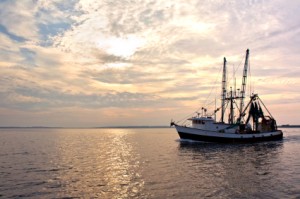
Rebuilding the Gulf’s Shattered Fishing Industry ? On Land

Today NOAA announced further fishing closures in the Gulf of Mexico due to the BP Deepwater Horizon oil spill. Now a total of 37 percent of federal Gulf waters are off limits to fishing, an area of nearly 89,000 square miles where NOAA considers fish and shellfish potentially too toxic for human consumption. For a region where commercial fishing is a vital part of the economy, the future of the region grows increasingly uncertain with each barrel of oil spewed into the deep Gulf waters.

There’s a solution: Rebuild the Gulf of Mexico fishery on land. Investing in “next-generation” sustainable land-based, closed-containment recirculating aquaculture systems (RAS) could keep the Gulf region in the seafood business profitably, while creating green jobs and reducing fishing pressure on wild stocks. What is “next-generation” RAS aquaculture? From the outside, many of the systems look like an ordinary warehouse. Inside, they’re a specially-constructed system of pumps and filters that recycle 99 percent of their water and grow healthy and heathful fish without chemicals, antibiotics or genetically-modified anything. Read more

2010: The Year We Wake and Act

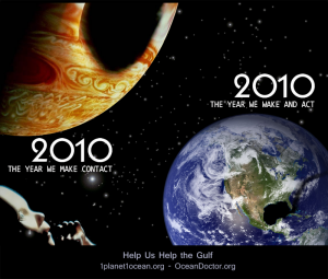
Like closing your eyes after staring at a light bulb, the image of the vast, dark spill haunts me like an after-image that just won’t go away after more than a month of poring over satellite images and nautical charts of the vast BP oil spill spreading throughout the Gulf of Mexico. At some point, as I pondered the growing dark mass, I recalled the eerie 1984 film, 2010 (the sequel to Arthur C. Clark’s 2001: A Space Odyssey) and the massive dark mass that consumed the planet Jupiter. And it seemed a tad spooky that the year the author chose when Jupiter would face its ginormous black swath of destruction was…2010.? Not knowing where it would lead me, I decided I had to indulge my right brain today, so I cracked my knuckles, opened Photoshop and this image is the result.? Read more

Waiting for the Oil?

Seven Mile Bridge in the Florida Keys

On July 18, 1975, the tanker Garbis spilled 1,500 to 3,000 barrels of crude oil into the warm, turquoise, coral-rich waters roughly 26 miles south-southwest of the Marquesas Keys, Florida. The oil was blown ashore along a 30-mile stretch of the Florida Keys, east of Key West. I was 16 and enjoying my second summer at Seacamp, a marine science camp on Big Pine Key. Rumors of the spill raced throughout the campus until finally, instructor James Smithson decided to find out for himself what menace might be approaching. He took a small away team aboard his 21-foot Mako, “Isurus,” and made haste south toward the reef tract. We waited impatiently for word back as the sun fell to the horizon and scattered its tranquil orange glow across the water. What I saw next filled me with dread. The Isurus entered the harbor, its white hull stained with enormous swaths of dark brown oil. In that moment the menace was no longer abstract, and to my young mind, everything we treasured — the corals, the mangroves, the fish, the turtles –was on the brink of extermination. Read more

Cuba Could Be Impacted by Gulf Oil Spill

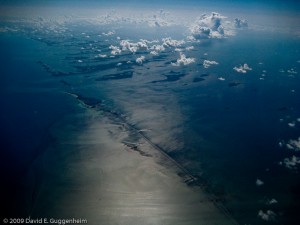
Cuba’s Northwestern Coast Along the Gulf of Mexico

For the most up-to-date information on the BP Deepwater Horizon oil spill’s potential impacts on Cuba, please visit our special “Cuba at Risk” page.

Since its discovery of oil and natural gas reserves in the Florida straits, Cuba’s preparations for full-scale offshore oil and gas development has raised alarm in the United States, particularly in Florida where it is estimated that much of a catastrophic spill originating in Cuba would be swept by Gulf currents. Ironically, it is now Cuba that faces the threat of a massive oil spill by the United States. The disastrous oil spill from the BP Deepwater Horizon now threatens Cuba, the largest and most biologically diverse island in the Caribbean, due to those same Gulf currents. To make matters worse, the economic embargo imposed upon Cuba by the United States decades ago makes collaboration and coordination exceedingly difficult during this crisis. Read more

Tri-National Collaboration Resource Page: BP Deepwater Horizon Oil Spill

NOTE: For the latest information on the potential impact of the Deepwater Horizon oil spill on Cuba, including the movement of the oil spill, please consult the special “Cuba at Risk” page.

This page has been established to facilitate the sharing of information among colleagues in Cuba, M?xico and the United States on potential impacts from the BP Deepwater Horizon Oil Spill. This is an effort of the tri-national collaboration established in 2007 among the three countries bordering the Gulf of M?xico to elevate collaboration in marine research and conservation to a new level. If you would like to contribute information or have any questions, please contact us.


[download_page]

External Links

NOAA Office of Response & Restoration: Deepwater Horizon Emergency Response Page

Deepwater Horizon Unified Command: Deepwater Horizon Response Page

Roffer’s Ocean Fishing Forecasting Service: Deepwater Horizon Rig Oil Spill Monitoring Page

NASA: Oil Spill Imagery Page

ESRI: Gulf of Mexico Oil Spill Map (Interactive)

Google Crisis Response: Gulf of Mexico Map (Interactive)

SkyTruth: Gulf Oil Spill Tracker (Interactive)

NCAR/UCAR: Ocean Currents Likely to Carry Oil Along Atlantic Coast (Modeling Results)

Media Coverage

CNN: Cuba Faces Possible Oil Threat (26-May-2010)

NPR/WGCU: Gulf Oil Spill Effects on Wildlife and Environment (20-May-2010)

Miami Herald: Cuba concerned Gulf oil spill may damage coast (19-May-2010)

Miami Herald: Concerns grow that Gulf oil spill could reach Florida Keys

Global Times: Cuba monitors oil spill in Gulf of Mexico